The date was 3.10, and our tasks were an aquatic vegetation survey and determining the water surface height by levelling. The weather was partly cloudy, with an atmospheric temperature of +5 °C. There was no rain. We were participated Chloé, Kerkko, Juliette, and Thomas.
Task 7 : Aquatic Vegetation Survey
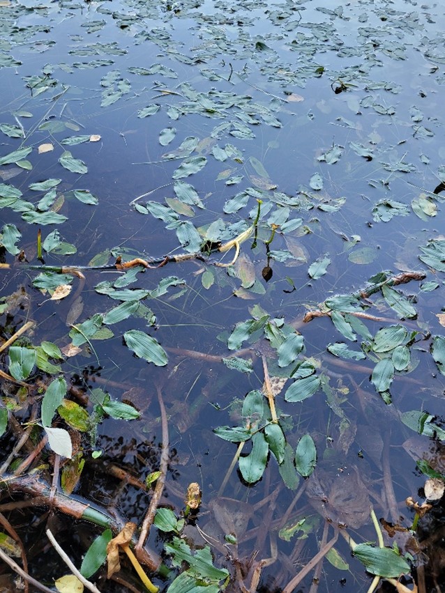
Water plants in limnology are grouped by their ecological niche :
- Aerial vegetation (helophytes) : Plants that grow above the water.
- Submerged vegetation (elodeids) : Plants that are completely underwater.
- Surface vegetation (lemnids) : Plants that float on the water surface.
- Bottom vegetation (isoetids) : Plants rooted at the lake bottom.
- Free floaters : Plants that float freely in the water.
- Suspended vegetation : Plants that hang in the water.
- Water mosses (bryids) : Mosses that grow in or around water.
 |
| Locations of the survey |
On the Beach :
 |
|
 |
|
 |
|
 |
|
Near the Outlet :
 |
|
 |
|
On the South Shore :
 |
|
 |
|
Kerkko used his former knowledge, I naturalist and Wikipedia
to name the plants so the accuracy of the identifications is questionable. He also didn’t include plants that he could not guess a name for. There was a lack
of bottom vegetation and water mosses in the survey since we didn’t have tools
to collect them.
Observations and analysis :
The survey showed mostly mixed vegetation with fewer floating plants. The limited number of surface-floating plants indicates possible eutrophication, as excessive nutrient input can lead to overgrowth of certain species, reducing biodiversity. The water appeared to have low nutrients, as seen by the presence of species that thrive in cleaner waters. This balance suggests that while the lake is not in perfect condition, it is not severely degraded either.
The hill next to the lake contributes soil and debris when it rains. This process can lead to an accumulation of particles on the lake's surface, which can negatively affect water clarity and quality. Increased rainfall can wash more sediment into the lake, potentially altering habitats and nutrient levels, which can impact the growth of aquatic plants and the health of the overall ecosystem.
Conclusion :
The aquatic vegetation survey of Pieni-Valkeinen Lake provided valuable insights into the current ecological state of the water body. The variety of plants identified indicates the lake's nutrient levels and overall health. While some species suggest that the lake is in relatively good condition, ongoing monitoring is essential to prevent eutrophication caused by runoff and sediment deposition.
Future surveys should aim to include more plant types and consider seasonal changes to gain a fuller understanding of the ecosystem. Effective management of runoff and sediment from the hill is crucial to maintain water quality and support a diverse aquatic environment.
Task 6 : Determining the water surface height by levelling
The goal of this task is to measure the water level in 2 different points, one for Pieni-Valkeinen Lake and the other one for Iso-Valkeinen Lake. Those measurements can be done thanks to a levelling machine, this one is pretty accurate and could measure a height to nearest millimeter. The levelling machine offer the possibility of measuring the difference of height between two points, which allow us to obtain the water level. It is essential to precise that the levelling machine has to be straight, a bubble on one side help us to find if we put it in the right way. The difficulty was to balance the bubble in the middle and to have the best placement to do the measures.
 |
| Optical level instrument |
Firstly, we have to determinate the water level of Pieni-Valkeinen.
That’s why after balancing and adjusting the measurement tools described before, we took 2 measurements of height. The first measure was made at the manhole cover, knowing that the altitude of the first measurement point compared to the sea level is equal to H0 = +99,064 m.
 |
| Reference location of Pieni-Valkeinen |
 |
| Pieni-Valkeinen's map |
H1 = 149,2 cm = 1,492 m
The second
measure was made at the lake edge in order to calculate the difference
levelling machine and lake surface.
H2 = 339,1
cm = 3,391 m
Thanks to
these values, we can now calculate the water level of this lake by following
these steps :
The height
of the levelling machine is H0 + H1 = 100,6 m
Finally,
the water level is equal to : H0 + H1 – H2 = 97,17 m
We wanted to compare the final value to the reference value that we can see in the map, the water level of the Piene-Valkeinen lake must be equal to 96,3 meters. By calculating the relative gap between these experiment and theoretical values : RG = 1% ;
we can conclude that the value of the water level of this lake that we found by experimentation is extremely close to the theoretical one. So that, the measurement uncertainties are not so important in this case.
Secondly, we have to determinate the water level of Iso-Valkeinen lake.
We also took
2 measurements of height. The first measure was made in the middle of a stump
near the lake, knowing that the altitude of this point compared to the sea
level is equal to H0 = +91,781 m.
Reference location of Iso-Valkeinen

 |
| Iso-Valkeinen's map |
H1 = 275 cm
= 2,75 m
The second
measure was made at the lake edge in order to calculate the difference
levelling machine and lake surface.
H2 = 254,8 cm
= 2,548 m
Thanks to
these values, we can now calculate the water level of this lake by following
these steps :
The height
of the levelling machine is H0 + H1 = 94,53
m.
Finally,
the water level is equal to : H0 + H1 – H2 = 91,98 m
We wanted
to compare the final value to the reference value that we can see in the map,
the water level of the Iso-Valkeinen lake must be equal to 89,1 meters. By
calculating the relative gap between these experiment and theoretical values :
RG=3%
For the
water level of this lake the result is less accurate but the relative gap is
under 5% so the measure is totally consistent.
Conclusion :
To conclude on this experience, we can say that the measurement is globally consistent. Nevertheless we can notice little difference with the theorical values. Those difference could come from several things. The first one is about the way that we balance the bubble in the middle of the circle to put the machine straight. We have tried to do our best to put it out the center but of course it was not perfectly in the center. Secondly, some mistakes could have be made during the lecture of the measurement. Finally, maybe we were not exactly at the good position when we took the measure, just one or two millimeters could influence the final results.
Kommentit
Lähetä kommentti